In Europe, different types of monitoring networks currently exist in parallel. Many EU Member states developed their own national soil information monitoring system, some being in place for decades (e.g. the Hungarian Soil Information and Monitoring System). In parallel in 2009, the European Commission extended the periodic Land Use/Land Cover Area Frame Survey (LUCAS) led by EUROSTAT to sample and analyse the main properties of topsoil in EU in order to develop a homogeneous dataset for EU.
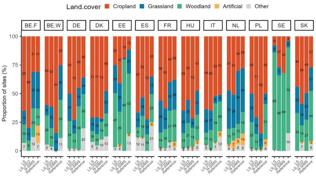
The latest publication compares the soil sampling strategies (e.g. spatial density, distribution of soil types and land cover) within countries in the national and the European soil information system. The distribution of three basic soil properties (pH, organic carbon, and clay content) and two soil health indicators (organic carbon/clay ratio and pH classes) are also compared. The comparison highlights the differences and gaps between national and international soil information databases across countries, the potential and obstacles to their combined use, and the need to harmonise the methodology used by each country.


